LBI Fishing Report 6/12/24

The surf temp on LBI is warm in the mid 60’s and the water is gin clear. Most of the big bass/drum spring run is behind us but there’s good “summertime” fishing. Right now anglers fishing LBI are catching fluke and blues. There are striped bass still around and there will be residents all summer. A few weakfish are here with most coming up as surprise bycatch. However some anglers are targeting them and catching in the surf and bay. The bay has great crabbing and clamming right now. Mid-shore and offshore sea bass, shark and tuna make for a well rounded spread of opportunities. Now’s the time to enjoy before the crazy peak summer traffic!

Fishing Barnegat Bay’s West Side Highway

Barnegat Bay, spanning 64 square miles, is a relatively shallow body of water which runs from Bay Head, behind Island Beach State Park and Long Beach Island to Little Egg Harbor. Teeming with diverse aquatic life, the bay offers anglers an array of fishing opportunities throughout the spring, summer, and fall seasons.

On the West Side of the bay anglers encounter a muddy bottom with areas of grass beds, lower salinity, low visibility and much less tide movement as opposed to areas closer to the inlet. This estuary provides a much different opportunity to fish. The West Side waters warms up quicker in the spring and they have a population of small forage. The forage attracts gamefish and the stained waters give anglers an advantage by reducing fish wariness.

Nestled within the heart of Barnegat Bay lies three daymarks delineating safe water along the Intracoastal Waterway, a vital component of the broader maritime landscape. These navigational aids serve as waypoints for mariners, guiding them through the bay’s waters.

These three wooden towers from south to north reside behind…

  • 42 – Off of Barnegat, marks the west side start of Double Creek Creek Channel
  • BI – Off of Waretown, marks the west side start of Oyster Creek Channel which is the largest and deepest channel that leads to Barnegat Inlet.
  • BB – Off of Forked River, marks the open Barnegat Bay as well as the entrance to the Forked River.

There are approximately 2 miles between each. The average depth in this 6 mile stretch is 7 to 8 feet, with deeper water at and around the BB 8-10 and a little deeper in some spots.

I rarely stray south of the 42 or north of the BB, as this is my home base. But there’s opportunities to the north and the south of here utilizing the same techniques I’m about to dive into. Depending on the time of year, I am pursuing stripers, blues, fluke, weakfish, kingfish, or blowfish somewhere in this stretch.

This is how we fish the Barnegat Bay’s “West Side Highway” aboard Hi Flier Fishing Charters.

A tactic we use for early season stripers and May/June blues is to troll 5 to 6 inch, floating, Yo-Zuri Crystal Minnows or Daiwa SP Minnows in subdued natural patterns, dark backs and white bellies. Using a pair of 10 to 12 lb spinning gear, drop them way back and put them in a set of outrodders to keep the tips low and the plugs in the water. Be sure to use a snap to connect the plug, do not tie direct or use a snap swivel, as either of these will kill the action. If your gear is light enough either of these lures will give the rod tip a slight pulse. The hardest part of trolling Barnegat Bay at any time of year, is keeping the lures clean, especially with this very long drop back. If the plug picks up the smallest piece of weed or debris, that pulse will stop and you need to crank it in, clean it up, and re-launch it. This can be exhausting at times but if there’s anything on the lure than you’re not even fishing. 3 to 3.5 knots for bass and 4 to 4.5 knots for the blues.

Somewhere around the third week in April, I start the season on the striper hunt in these backwaters. I start about a half mile south of the BB and troll right to it. If there’s no life worth doubling back on, set a course for Tices Shoal and look for birds or swirling fish. Have some spinning rods armed with soft plastics in case you get a shot at casting fish. These stripers are typically anywhere from 20 to 30 inch fish.

All of May and June you can usually troll 1 to 4 lb bluefish on this West Side Highway. If you want to have even more fun with these fish, go east of this line and the water will shallow up. Once you are in 3 to 4 feet of water, blind cast poppers or any surface lure. Crank it fast and splashy. If you get one chasing, don’t slow it down, you’re only shot is to keep it coming. If you don’t get any reactions after 5 minutes, make a move and keep hunting. More often than not, I get on these fish with no visual life, just keep hunting until you get one chasing. FYI: These might be the world’s best bluefish to eat as they are small enough where they do not have that strong bloodline throughout, the meat is very light when you fillet them. Also, they feed almost exclusively on sand shrimp at this time of year. Anything that feeds exclusively on shrimp takes on some of that sweetness. I’m not saying they are as good as fluke or weakfish, just that as far as bluefish goes, as table fare, these are the best. 

From July 1 to Sept 30, I like to anchor up with live shedder crab in hopes of weakfish and kingfish. Cut up some crab and tip an 1/8 or 1/16 oz jig. Flip it out as far as you can behind the boat and work it back with what I call a “lollygag” retrieve. After the cast, let it hit bottom, then lift the rod painfully slow. Lower the rod and only capture the slack you created from the lift. Do this all the way back to the boat. When you feel a tick or a thump, cross his eyes! I usually use the 6 lb spinning rods for this. I am partial to anchoring a little southeast of the 42 or in the deepest water halfway between the BI and BB, which you will find as 11 or 12 feet.

July, August, and September also brings peak blowfishing to this stretch. Anchor up in 6 to 8 foot of water, which will be a little east of this highway. Put a chum pot down with a frozen clam chum log. Tie on some store bought blowfish or winter flounder rigs. Cut up some squid and clams into small strips and you are good to go. Bring a lot of chum because if you don’t get any in the first 15 minutes, it’s time to move. These are a lot of fun to catch and in the end you have a Ziploc of delicious fish. I use a chunking knife to cut right behind the head, go through the meat but not through the bottom layer of skin. Peel back a little of the skin right at the cut on the top to expose some of the flesh. Jab a fork that you stole from the silverware drawer into this flesh and pull back on the semi severed head slow and steady until it peels away all the skin, and you are left with a nice chunk of white meat. Use some shears to cut away any fins. Peel away any schmutz or lining and it is ready for the fryer.

See you out there!

Captain Dave DeGennaro, Hi Flier Sportfishing

HiFlier.com – Call/Text: 732.330.5674

More About Captain Dave

After decades of targeting saltwater gamefish inshore from fluke, weakfish and striped bass to big game offshore fishing for giant tuna and sharks, Captain Dave DeGennaro is a well versed captain who does it all.

Captain Dave has a knack for finding fish season in and season out. After 40+ years on the local waters, he knows them like the back of his hand. Also his knowledge and ability to deploy both modern as well as classic even old school methods set him apart from the fleet and keep the lines tight.

He works hard to ensure his clients are safe and happy while enjoying their time on the water aboard his 25′ World Cat catamaran. It’s a wide, very stable and soft riding boat that is super sea worthy. It performs great in the ocean as well as the shallow bay. Hi Flier Sportfishing can accommodate parties up to 6 on bay trips and 4 for ocean trips.

Contact Captain Dave DeGennaro today for your next fishing charter adventure... HiFlier.com – Call/Text: 732.330.5674

Long Beach Island Fishing Spots

Here’s a list of Long Beach Island fishing spots to enjoy fishing and crabbing on the Island. The spots are listed from north to south. Please have fun, be safe, treat these areas as if they were your precious secret spot and always be respectful to the area and others. Carry out what your carry in! Leave the place cleaner than you found it!

North End Fishing

Barnegat Lighthouse State Park

Old Barny Light House, Barnegat Light (N39.764352, W74.106227)

Located at the northern tip of Long Beach Island, Barnegat Light offers a variety of fishing opportunities. The bayside, the Inlet and the surf (front beach) are all fishy areas for many different species during the year. 

Barnegat Light’s Inlet Jetty (aka South Jetty)

Barnegat Inlet’s Jetty (aka South Jetty) is a very productive area to fish any time of year for a variety of species. The most popular species are striped bass and bluefish as well as tog and fluke. Anglers fish the rips near the lighthouse and along the concrete walk way. Some explore and creep the jetty further out. Depending on the day, conditions and tide fishing can be great anywhere along the Jetty. Please use extreme caution when fishing the rocks especially when wet. Be safe and wear the appropriate footwear like Korkers jetty cleats to ensure footing.

Barnegat Light’s Town Beaches

Barnegat Light’s Town Beaches (surf) are known for holding big trophy striped bass in the prime time season. These beaches are also great for fluke. Keep in mind some areas have very long dune paths to reach the water’s edge.

Barnegat Light’s Bayside

Barnegat Light’s Bayside has a large length of public bulkhead. This begins behind the Condos (4th and 5th Street) and continues to the area at the “end of the road” that is right outside the entrance to the park. This entire area can be very good and a great place with protection when the wind and swell have the Inlet churned up. In season tog fishing as well as fluke fishing here is very good. There are some snags in areas. This area can be great at night when the street lights draw in bait and feeding predators. Another area to fish the North End’s bayside is the open area south of the Barnegat Light Bay Beach (light tackle fluke or top water bass) and High Bar Harbor Dike.

The Dike – High Bar Harbor

The Dike at High Bar Harbor, Barnegat Light (N39.758111, W74.119707)

The Dike is a peninsula of land that extends out into the bay offering anglers a variety of options. Fly fisherman love the diversity of the water from shallow rolling flats to deep fast moving water. Barnegat Bay’s main thoroughfares Double Creek Channel and Oyster Creek Channel merge at its tip producing beautiful rippy water that is great for targeting striped bass as well as fluke, bluefish and weakfish. The Dike’s close proximity to Barnegat Inlet is one of its key features. Any fish that moves in or out of Barnegat Bay by way of Barnegat Inlet has to move past the Dike. Fishing can be great on both the east and west side. Do not hike through the over grown trees. It is infested with poison ivy and ticks. CAUTION!!!

Directions to the Dike at High Bar Harbor:
Once on LBI, take Long Beach Blvd north to Barnegat Light. Turn left on 20th street and continue straight through the next intersection. Then as the road bends (to the left) make your first right and then another quick right onto Sunset Blvd. At the end of the road, the sandy trail is the entrance.

Harvey Cedars Bayside Pier

Sunset Park, Harvey Cedars (N39.693943, W74.143886)

Harvey Cedars Sunset Park has a pier for crabbing and fishing. It is located near the Harvey Cedars Water tower. The entrance to the park is at West Salem Ave.

Harvey Cedars has a few public street ends that are great to explore for fishing and crabbing. The surf fishing here can be very productive just like the town to the north Loveladies and to the south North Beach. Harvey Cedars used to have many large jetties however numerous rounds of beach replenishment have buried them. When there is swell in the water, Cedars is well know for having the largest surf on LBI as well as a break that is closer to shore. It is also know for beach erosion too so the beaches can be short and steep.

Mid-Island Fishing

Surf City Bayside

Surf City has many public street end bulkheads that can be fished and crabbed. Some are better and have more space than others; 24th, 13th, 3rd, North 1st and Shore Ave, South 2nd.

The Surf City Public Boat Ramp on the bayside of Division Ave has a small area on both sides of the ramp that can be utilized for fishing and crabbing.

Surf City Surf Fishing

The beaches of Surf City are great for surf fishing spring, summer and fall. However in the summer months they have been historically closed to fishing during the daytime lifeguard hours. For more specifics consult with the Surf City Beach Patrol. During this peak summer season, fish early or fish late in the day.

Ship Bottom Bayside

Our home town at the heart of Long Beach Island, Ship Bottom offers opportunity for vacationers and day trippers to fish and crab without traveling too far. The Rt 72 Causeway Bridges offers some of Long Beach Island’s best and easiest fishing and crabbing access. There are numerous areas around and under all four bridges. Between 3rd and 4th street on the bay there is small yet spacious “Remembrance Park” with public parking with a  dock/bulkhead. It is an area dedicated to the victims of 9/11. The 6th street bay area used to be an awesome fishing spot with a large and open sand lot. But LBI has experiences a lot of development over the decades. However there is a little spot that remains at the west end of 6th street. There is also an area on 5th with a Gazebo and benches but here is for sunset than fishing.

Robert Nissen Park (Ship Bottom Boat Ramp, Bayside)

Robert Nissen Park (Ship Bottom Boat Ramp) is located on the bayside in Ship Bottom (10th – 12th Street) on the south side of the Causeway entering Long Beach Island. There is a large gravel lot for parking and there is a four plus block water front that can be fished. The Ship Bottom Fishing & Crabbing Pier is located net to the boat ramp. Depending on the season a variety of species are on tap. Anglers can fish with light tackle in the summer and target snapper bluefish, weakfish, fluke, blowfish, kingfish and spot. Also in the warmer month it is a great place to night fishing for sharks and rays. In the fall and spring striped bass, bluefish and drum are frequently caught. The area is also a good winter flounder spot in season.

Beach Arlington Park (aka Sunset Park, Ship Bottom Bay Beach)

Beach Arlington Park (aka Sunset Park, Ship Bottom Bay Beach) is located between 13th-16th on the bay in Ship Bottom. It is a summer time bathing “bay beach” area that is very popular among families, but in the offseason it can be a very good area to fish the bayside. It is best fished wading because it is shallow in close. There is a channel within casting distance. Certain times of year striped bass, bluefish, weakfish, fluke, blowfish and black drum are cruising the channel. It is a great place to launch a kayak to fish the eastern bridges and Ship Bottom’s bayside islands.

Ship Bottom Crab Cove Pier

Ship Bottom Crab Cove Pier is located on the on Central Ave between 25th and 26th Street in Ship Bottom. It is a great place to crab in the summer time. It usually isn’t much of a fishing spot but at times in the summer it can have a few snappers. Get there early because it can be crazy mid day and especially on the weekends.

Ship Bottom Surf Fishing

The beaches of Ship Bottom offer easy access with great opportunities for surf fishing. Usually Ship Bottom is know for having an outer bar which is out of casting range. Here angler focus their attention on the long shore sloughs and the “cuts” flowing through the bar. In the various season, these areas hold striped bass, bluefish, fluke, kingfish among other species.

Long Beach Township

Long Beach Township makes up a long stretch of the Island between Ship Bottom and Beach Haven. This open stretch of beach is great for surf fishing but like all of LBI, there’s shifting sandbars so the cuts and hole change frequently. Scout around and you’ll find some great water for surf fishing. This section of Long Beach Township also has many public street ends that can be good for fishing an crabbing; 53rd, 59th Kimberly, 67th Pier at Bayview Park, Harrington, Jeanette, Bayberry, Jerome, Alabama, California, Hideaway Bay/Cove bulkhead and kayak launch, Colorado, Utah, Mac Evoy, Ramapo,  Ohio, Indiana, 32-29, 15-13.

From Brant Beach’s 31st street (bordering Ship Bottom’s south side) to 13th Street in North Beach Haven (bordering Beach Haven’s north side) the mid-Island stretch of Long Beach Township is 5.3 miles of open public beaches. Here surf anglers will find similar beach set ups to Ship Bottom and Surf City with variety. Some areas are wide while and other areas short. Some have sandbars in close and others are further out. Like all of LBI the beaches change often.

South End Fishing

Beach Haven

Home to one of LBI’s largest surf side rock jetties, Holyoak Avenue, Beach Haven has great surf fishing for a variety of species in the spring, summer and fall. In the summer, fishing is allowed outside of the lifeguard flag designated bathing and surfing area of the beach.

Beach Haven Public Docks

The Queen City of LBI, Beach Haven has a large Public Dock area with phenomenal fishing. It is located at the west end of 2nd Street Dock Road. The bulkhead/boardwalk area has plenty of parking. The area offers some of the Island’s best bayside fishing. Depending on the season, a variety of species are on tap. In the summertime it is a great place to target weakfish, striped bass, fluke as well as sharks at night. In the spring and fall stripers love to cruise the lights at night looking for small bait.

There is also a public bay front area at west end of 9th and also Taylor ave however it isn’t great for fishing or crabbing. If trying here, it is better to use the northern end of the property just don’t restrict access to the boat launch. Other spots to explore include Center, Engleside, Amber, Coral as well as numerous street ends along West Ave. Technically it’s the town of Holgate, Rosemma Ave has a skinny access trail to the marshland – sod bank which is a historic fishing spot adjacent to the Clam Cove Reserve. Do not trespass on private property.

Holgate – Edwin B. Forsythe National Wildlife Refuge

Edwin B. Forsythe Holgate Unit, Long Beach Township (N39.531009, W74.263405)

Located at the southern tip of Long Beach Island, the Holgate Unit of the Edwin B. Forsythe National Wildlife Refuge is part of Forsythe’s designated Wilderness Area. It consists of more than 400 acres of barrier beaches, dunes and tidal salt marsh. One of New Jersey’s last remaining undeveloped barrier islands.

Holgate is a beautiful stretch of beach to fish during the day or night. It offers phenomenal fishing in the early fall during the mullet run (September) when bass, blues and fluke go crazy over mullet that are pouring out of the bay. The back side offers great clamming. Take note of daily tides and wind/swell forecast. Sometime around the moons the extreme tides can steal beach fast, cutting off the driving path at certain spots. Some times anglers are trapped and have to stay until the next tide. Use extreme caution and always make sure you have enough gas.

Holgate is best fished via 4×4 (need Long Beach Township permit) but there are opportunities for anglers with out a beach buggy too. Take Long Beach Blvd south all the way to the parking lot at the end of the road. This lot is a good place to park for those without 4×4, looking to fish the front beach via walk on access. HOWEVER!!!! This area, better known as Beach One and the Wooden Jetty, is one of the most popular surfing beaches on the Island, state and even region. If looking to fish this area do so at night or when when flat clam. We do not advise fishing here during sunlight hours as it is ruled with surfers.

Beach One Jetty is straight off of Washington Ave and the Wooden Jetty is the groin to the south. In Feb 2019 a metal “terminal groin” was sistered along side of the Wooden Jetty to help hold sand on Beach One and arguably protect the dunes and parking lot. It arguably created significantly more erosion to its south which in time very well may cut off access to the Refuge and become Beach Haven Inlet again.

**Access to Holgate is subject to special regulations. Pedestrians are allowed only on the beach and must stay out of the dunes to protect this fragile habitat. Vehicles are not permitted above the high tide line and a permit must be obtained from Long Beach Township for access to the site. The Holgate Unit is usually open to beach buggies September 1 through March 31 or as posted. Information on current status of vehicle access and beach buggy permits can be obtained from Long Beach Township at (609) 361-1000 or the Long Beach Township Police department at (609) 494-3322.

Fishing Spots on the Mainland

The following are fishing spots on the mainland not far from Long Beach Island. The spots are listed from north around Cedar Creek in Bayville down to south areas of the Mullica River.

John C Bartlett County Park

Bayville, NJ (N39.8229550, W74.1607102)

The Berkeley Island Park is a great to enjoy the Barnegat Bay with lots of area for both fishing and crabbing. There’s ample parking, a lot of dock space and a T-pier.

Laurel Boulevard Bay Front

Lanoka Harbor, NJ (N39.8229550, W74.1607102)

Along Laurel Blvd there are a couple public areas to fish. One, at the sand beach by the Gazebo. Two, to the south of there by the bend in the road.

Forked River Bay Front Park

Forked River, NJ (N39.8229550, W74.1607102)

This open area with public parking and some area to fish. It is the area just to the south side of the Forked River. It has a playground so it’s good for kids.

Oyster Creek Outflow

Oyster Creek Rt. 9 Bridge – Lacey Township, NJ (N39.811231, W74.199641)

The Oyster Creek Power Generating Station’s warm water discharge offered decades of awesome fishing as the hot spot held great year round fishing. It was shut down in 2018 Oyster Creek and subsequently the warm water outflow slowed and is nearly the same temperature as the bay. It was loved by stripers, weakfish, bluefish, winter flounder and anglers. Even in the cold of winter Oyster Creek would hungry striped bass. The hot bait was on bloodworm and the hot lures were small bucktails and soft plastics as well as small swimming plugs. Today fishing can be done at the Creek but it is not nearly as productive as it once was. Areas to fish are from the top of the east side of the Rt9 bridge. Do not fish the west side! And do not wonder around on the west side of Rt.9! The power plant has extra high security. It is best to cross the bridge and walk the Creek’s north side bank. Fish anywhere along the bank. Fishing can be good at the mouth of the creek however, access is difficult. Do not trespass on private property!

Directions to Oyster Creek: From LBI Take Rt.9 north past Waretown towards Forked River. You’re getting close once the Power Plants smoke stacks are visible. Park on the south side of the bridge and on the east side of the street. Park on the side of the street or in the small dirt lot. 

Waretown Public Docks

Waretown, NJ (N39.7914992, W74.1826289)

At the end of Bryant Road, this location has a nice long dock or T-pier for fishing and crabbing.

Barnegat Public Docks

Barnegat, NJ (N39.749315, W74.192656)

The Barnegat Township Public Docks and Municipal Boat Ramp has a large gravel public parking lot with a long stretch of boardwalk bulkheaded bay front dock. The area is well know for crabbing but it is also a great area to catch snapper during the day and weakfish at night when in season. When the bluefish invade Barnegat Bay another spot which is right around the corner is the Barnegat Public Bay Beach. It offers great fishing but you must wade out and use a longer rod like a 8 or 9′ light action plugging rod for more distance. Spring time bluefish action can be phenomenal where on poppers.

Directions to the Barnegat Public Docks: From the LBI area, take Rt.9 North. Once in Barnegat make right onto East Bay Ave. Continue over a small bridge and finally to the big gravel parking lot on the right side of the road with two story gazebo.

Bridge to No Where

Bridge to No Where, Stafford Township, NJ (N39.683927, W74.207613)

The Bridge to No Where is a very popular crabbing location that is located at the end of Stafford Ave. The Bridge was constructed in the 60-70’s by NJ Bell Telephone to run telephone poles and lines across the marshes. Since then it has been rundown and vandalized. Great crabbing! Look out for green heads!

Directions to the Bridge to No Where: From LBI take 72 west over all of the Causeway Bridges. Make right at first light, Marsha Drive then Left onto East Bay Ave. You will pass a gas station and marina on the right side. Then make a right on to Hilliard Blvd. Continue past the Manahawkin Elks Lodge Make a right onto Stafford Ave. The pot hole filled paved road will turn into gravel. Continue to the end of the road.

Cedar Run Dock Road

Dock Road Boat Ramp, Cedar Run, Stafford Township, NJ (N39.6437157, W74.2457654)

At the end of Dock Road there is a small boat ramp and bulkhead area which offers easy access for fishing and crabbing.

West Creek Dock Road

West Creek, NJ (N39.6142205, W74.2628564)

At the end of Dock Road there is a bulkheaded area which offers easy access for fishing and crabbing.

South Green Street Park

Tuckerton, NJ (N39.5766676, W74.3308008)

At the end of Green Street there is park, bulkheaded area and a T-Dock which is a great family spot with kids to fish and crab.

Graveling Point

Graveling Point, Osborn Island, Little Egg Harbor Township, NJ (N39.538612, W74.393345)

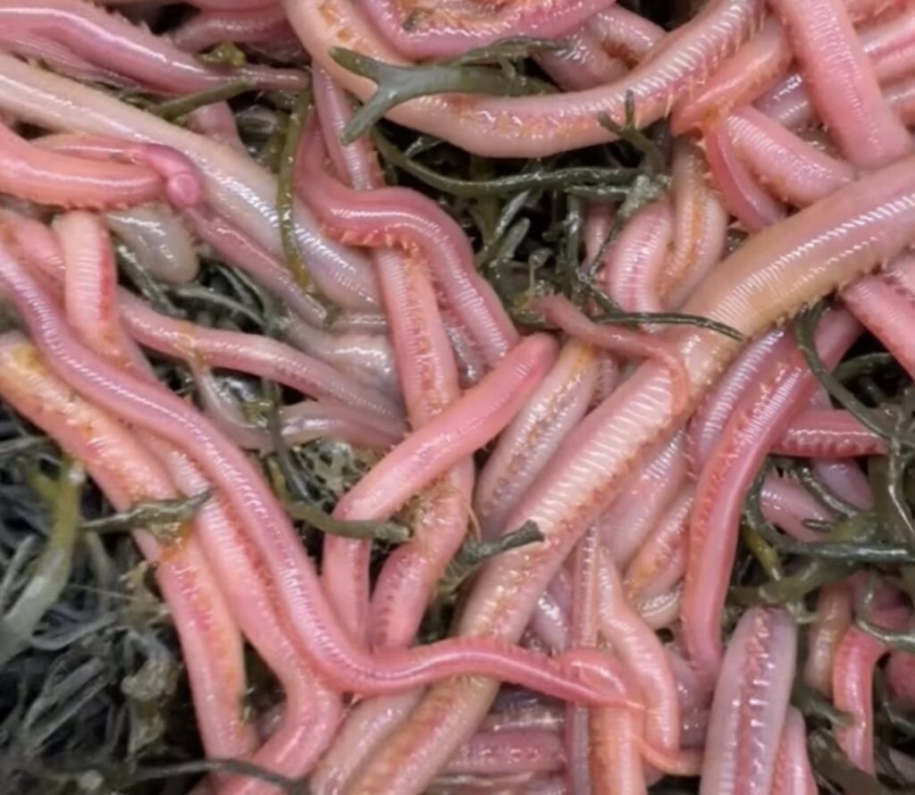
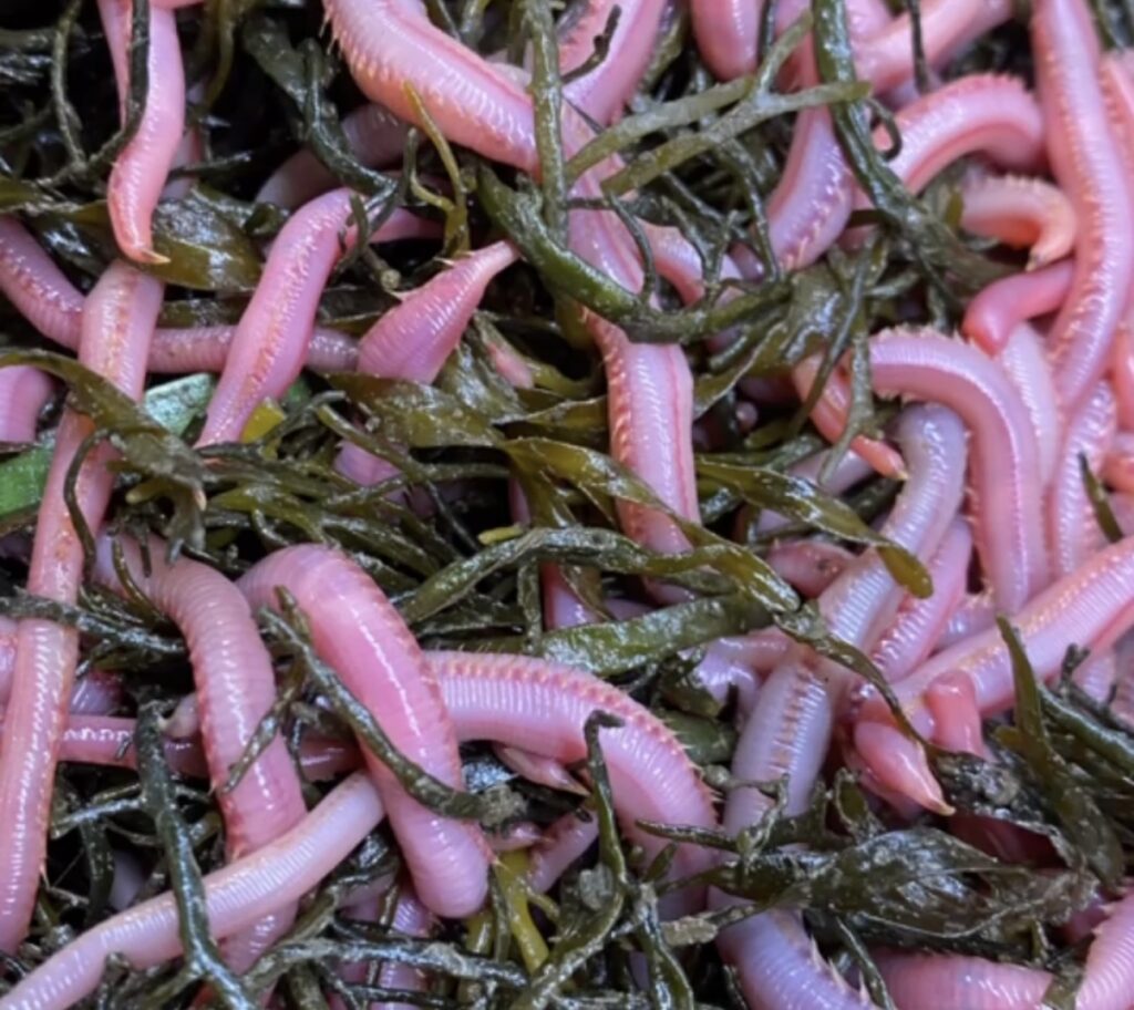
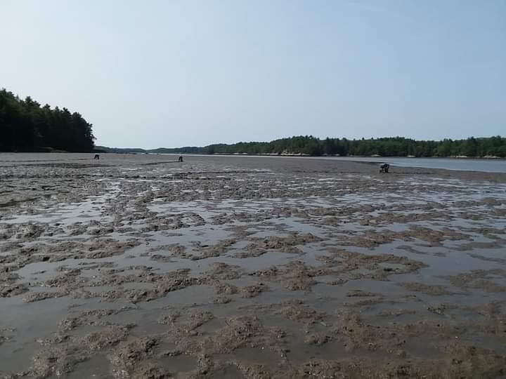
Graveling Point is a public fishing area that is part of the Edwin B. Forsythe National Wildlife Refuge Brigantine Division. It is a great early season hot spot for striped bass. Graveling Point is located near the mouth of the Mullica River where the sun warms the river’s outflow over the shallow water flats of Great Bay. Every year the seasons first striped bass are caught here. Fishing is best on the outgoing tide when the warmest water turns on the bite. It is very productive in March and April. Best bait is bloodworms. Graveling Point is mostly sod bank with some small sections of sand. We suggest wearing waders because in order to get out to the Point, one must cross a small creek.

Directions to Graveling Point: In the town of Tuckerton near the lake make a left on to Great Bay Blvd. Then in about a half mile make a right on Radio Rd. Continue over the small bridge to the end approximately 4 miles. Graveling Point is a few hundred yards to the right. Walk the sand beach heading west. Cross the small creek and then continue on along the sod bank. Fishing is great anywhere along the sod bank.

Seven Bridges Road

Great Bay Blvd., Little Egg Harbor Township, NJ (N39.509196, W74.320043)

Great Bay Blvd also known as Seven Bridges Road is a great area to fish and crab with a great view of the Atlantic City skyline! Although there are not seven bridges, the five offer great opportunities with the first and last two being the most popular. Fish the bridges and their surrounding areas or if they are busy with people drive all the way to the end and walk the trail to fish the bank. The first bridge crosses Big Thorofare, the second crosses Little Thorofare, the third crosses Jimmies Creek, the fourth crosses Big Sheepshead Creek and the fifth crosses Little Sheepshead Creek. At the end of the road is the Old Coast Guard Station which is now RUMFS, Rutgers University Marine Field Station. It’s a working lab with ongoing research year round.

Collins Cove

Collins Cove, Port Republic, NJ (N39.548247, W74.473983) 

Collins Cove is located on the Mullica River just west of the Parkway Bridge, about 2 miles west of Port Republic. Collins Cove was created when fill was removed to construct the Parkway Bridge over the Mullica River. Hence it’s massive hole which has some what filled in over time but still present. Collins Cove is know for its excellent white perch fishing in the winter and early spring. Depending on the year it can have great ice fishing in the dead of winter, January and February

Directions to Collins Cove: Take Parkway exit 48 which places you on route 9 South, about a half mile make a right-turn onto Rt 575 Chestnut Neck Road.
About two miles, make a right-turn onto Rt 624 Clark’s Landing Road. Right after you pass underneath the Parkway make the first right-hand turn onto the dirt road and drive parallel to the Parkway going North as far as possible into the Port Republic Wildlife Management Area. There is a small parking area at the end. At this point you will need to park and hike (yes, walk) less than 1 mile along a path NNE to Collin’s Cove.

There are many fishing spots along the banks of the Mullica River. Here are two of the more well known and easy access spots.

Hay Road Beach

Egg Harbor City, NJ (N39.5733920, W74.5395095) 

Hay Road is a great fishing access point to the Mullica River at Hog Island about 4 miles west of the Parkway Bridge. This an area that can be fished from the bank or a perfect areas to launch a kayak. It’s a prime early season spot for white perch and striped bass.

Lower Bank

Egg Harbor City, NJ (N39.5945439, W74.5497723) 

There are a couple areas to fish the Mullica River off of River Road; near the small River Road Boat Ramp and the Lower Bank Bridge.

2024 NJ Fishing Regulation Updates

What are the 2024 NJ fishing regulations for recreational anglers? Here are a few of the most popular target species…

Black Sea Bass:
May 17 – Jun 19, 12.5″ Minimum Size, 10 per person bag
Jul 1 – Aug 31, 12.5″ Minimum Size, 1 per person bag
Oct 1 – Oct 31, 12.5″ Minimum Size, 10 per person bag
Nov 1 – Dec 31, 12.5″ Minimum Size, 15 per person bag

Bluefish:
No Closed Season, No Minimum Size,
*Private/Shore Angler: 3 per person bag
*Anglers Aboard For-Hire: 5 per person bag

Drum, Black:
No Closed Season, 16″ Minimum Size, 3 per person bag

Flounder, Summer (Fluke):
May 4 – Sep 25, 18″ Minimum Size, 3 per person bag
*See NJFW for special exceptions

Flounder, Winter:
Mar 1 – Dec 31, 12″ Minimum Size, 2 per person bag

Porgy (Scup):
Jan 1 – Jan 30, 10″ Minimum Size, 30 per person bag
Sep 1 – Dec 31, 10″ Minimum Size, 30 per person bag

Striped Bass:
Ocean (State Waters 0-3NM): No Closed Season, 28-31″ Slot, 1 per person bag
Ocean (Federal Waters (>3MN): Closed Season, Prohibited
Bays/Rivers: Mar 1 – Dec 31, 28-31″ Slot, 1 per person bag
*See NJFW for special exceptions & NJ SBBP

Tautog (Tog / Blackfish):
Jan 1 – Feb 28 & Apr 1 – Apr 30, 15″ Minimum Size, 4 per person bag
Aug 1 – Nov 15, 15″ Minimum Size, 1 per person bag
Nov 16 – Dec 31, 15″ Minimum Size, 5 per person bag

Weakfish:
No Closed Season, 13″ Minimum Size, 1 per person bag

For the entire list of NJ saltwater fishing regulations see below and be sure to save the pdf link or print it out for future reference.

2024 NJ Fishing Regs, Seasons, Size & Bag Limit Laws

Click To Here To Download Printable PDF Version

All attempts made to ensure accuracy; however, fishery rules are subject to change. The data conveniently complied above was derived from the NJ Fish & Wildlife and NOAA Fisheries.

Original Post: Feb 23, 2024

With the spring fishing season approaching, everyone is asking us… What are the 2024 fishing regulations?

One would think these decisions would be made well in advance of the season however thats not the case. Due to the levels complexity with so many different regulatory bodies each one’s decision basically works down the line in a chain reaction. This year expect the NJ recreation fishing regulations to be finalized at the NJMFC meeting on 3/7 in Galloway 5pm.

Here’s Anthony Butch with more than his handful after a fun wreck fishing trip.

For the most part everything is the same except for the following 2024 changes…

  • Summer Flounder: 28% Reduction – See the list of 6 options in the chart below which are currently on the table. These all passed technical committee review confirming they meet the reduction mandate. *Update: The Summer Flounder Advisory Board meeting 2/28/24, all advisors were in favor of option 32. Since these advisors talk to a lot of the public and many different stake holder groups, it’s safe to say the majority is in favor of 32. For what it is worth, based on the social media posts that we made 80% were in favor of option 32. Option 57 had 9% and Option 23 has 7%.
  • Porgy/Scup: 10% Reduction – Expect a 30 fish bag at a 10″ minimum size with a with first half of the year season running 1/1/24 to 6/30/24 and then a second half season 9/1 to 12/31.

Yes we couldn’t believe the ASMFC news either but lets be honest going from last years reg to potentially 3 fish at 18″ looks like a win and liberalization and not a cut in most anglers eyes.

The New Jersey Marine Fisheries Council is seeking public comment on the 2024 NJ Recreational Summer Flounder options. The 6 are listed above, but note status quo is not an option and only there for reference. Written comments will be accepted through March 4, 2024 (11:59 p.m.) to njmarinefishpubliccomment@dep.nj.gov.

Submitted comments will become part of the public record for the NJ MFC public meeting 3/7/24 5pm at the Atlantic County Library, Galloway Township Branch, 306 East Jimmie Leeds Rd, Galloway, NJ.

2024 Winter NJ Fishing Shows

There’s no better way to pass winter than preparing for the spring season a head and attending some great fishing shows. This time of year there are numerous shows. Here’s some of the ones we consider the best and will be attendings

Saturday Feb 3 Canyon Runner Offshore Seminar Series
Harrah’s Resort – Atlantic City, NJ (9am-5pm): Attend the 21st annual event and learn from the best offshore captains in the game covering mid-shore and inshore tuna fishing as well as all of the top requested topics from previous years. Tickets required, must buy in advance from Canyon Runner… contact them for more info.

Saturday Feb 10th – Southern Regional High School Fishing Flea Market
Southern Regional Middle School – Manahawkin, NJ (8am-1pm): Come out and support the SRHS Fishing Club at their annual fundraising event, the areas best fishing flea market. We’ll have an even larger booth with lots of great deals and this year we are planning on a rod and Gulp blowout. You don’t want to miss it! $4 admission at the door, under 12 are free with adult.

Saturday Feb 17th – Surf Day 2024 by the Jersey Shore Surfcasters
Brookdale Community College – Lincroft, NJ (8:30am-4:30pm): The 100% SURF show! “A day dedicated to sufcasters”, Surf Day has a long history as the regions premier surf fishing show full of the best seminars from the best anglers. Every year it is a packed house with top vendors and sought after custom lure builders. As always we will have our same booth space stacked with surf fishing tackle from A to Z. See you there! $10 admission at the door, discount for all veterans.

March 15-17 – The Saltwater Fishing Expo
NJ Convention & Expo Center – Edison, NJ: It’s the best saltwater fishing show of the year, packed with great seminars, great vendors and for the most part the entire NJ fishing industry. Just like last year we will have a large booth (BOOTH401) with all of the saltwater fishing essentials, new trending hot products which we caught a lot of fish on last year as well as the best products from the top name brands. Best of all we’ll have some awesome show specials! Tickets available online and at the door, $15 adults, $5 children 6-11.

See you at the show!

PS: We are open daily all winter long, hours posted below.. If coming to the store, be aware the road construction on 9th Street in front of the shop is horrendous. We advise parking across the street at Country Corner’s stone lot.

LBI Fishing Report 6/12/23

Anglers fishing inshore, offshore and from shore are catching a variety of species in and around Long Beach Island. Here’s the Fishing LBI report update for Wednesday 12, 2023 with fishing information on bluefish, striped bass and fluke as well as an inshore bluefin tuna fishing report, wreck fishing, cobia, mahi and more. For a more detailed text report check out the last report posted on Monday July 10th.

At 8 minutes in, Greg shares details on a few lures that he like and fishes commonly. Here’s some links to them

Reel Reaction Sportfishing – Open dates Tautog/Bass

We are cancelled this weekend, but we have the following openings for tautog or striped bass. All tautog trips are 6hrs and include white crabs/tackle/gear/etc.

12/18, 12/28 booked, 12/29, 12/30 booked, 12/31, 1/2, 1/7 booked, 1/8.

Capt. Brett Taylor ~ www.reelreactioncharters.com

Call or text: 609-290-7709

Soft Plastic Perspective

Soft plastics are one of the best games in town for fall striped bass and shops like Fisherman HQ have a variety to put anglers on the bite. The mainstay of selecting the right lure depends on the type of bait the fish are feeding on. Striped bass are very opportunistic and aggressive feeders, especially during the migration as the need to fuel the migratory muscles and pack on calories for the winter drives the feeding. The use of plastics work in both the skinny backwaters, inlets as well as the beaches out to 3 nautical miles.

Spearing, anchovies, and smaller baitfish are mimicked perfectly by 3 to 4 inch Fin-S, paddle-tails, swim-shads, Zoom baits, and several Gulp baits. Depending on situation and depth 1/2oz, 3/4oz, and 1oz jig-heads will suffice for using these baits. When the fish are on larger baits such as mullet and bunker, the larger 5 to 6 inch swim shads will do. 1 to 2 oz weights or lure sizes may be needed to get down to the depths of feeding bass. Anglers can slow retrieve this lures or work them close to the bottom and when the bass are schooled – it’s usually game on for these types of baits.

If we get a run like last year, sand-eel impressions are also fantastic lures for migrating bass. These can be either added as a teaser or used as the main lure. Jigging metals with soft plastic sand-eel teasers work great when are bass feeding on these types of baits. There are quite a few manufacturers that have soft plastic sand-eel body types and these are an absolute necessity for anglers targeting November bass.

Next time your in the store, check out the soft plastic options to add to your arsenal!

Capt. Brett Taylor – Reel Reaction Sportfishing

Upwelling Events On Long Beach Island Explained

After a string of upwelling events this summer, some that could rank towards the top of historic records, everyone from anglers to surfers and bathers are asking, “Why’s the surf so cold?”

Attaching a thermometer to the back of a casting lure is a great way to monitor the water temperature when fishing.

Growing up on LBI, I’ve experienced our changing waters both fishing and surfing since a young age. Then in Oceanography Classes at Stockton College I learned more about our unique Cold Pool and the intricacies of our coastal dynamics. I’ve talked about it numerous times on my fishing report videos but never laid out a full blog post to comprehensively share information on the topic of upwelling on Long Beach Island. Here it goes!

Photo: Casting Lure and Thermometer, Steve George, Night Strikes Guide Service

The Cold Pool

What is the source of the cold water?

The waters of the New York – New Jersey Bight (Cape May, NJ to Montauk, NY) are unique. It is arctic in the winter with water temps in the 30’s and it is tropical in the summer with water at times reaching the 80’s. These are some of the largest ranging ocean temperatures in the world.

The waters change over the season…

WINTER: During the coldest months of the calendar (December–March) the water is well-mixed.

SPRING: April and May are the spring transitional months when the days get longer and the weather patterns calm. During this time the ocean’s surface temperature warms and stratification occurs creating a two layer summer ocean.

SUMMER: All summer, June/July/August/September the surface layer remains warm, but the bottom layer remains cold. This cold bottom water is known as The Bight’s Cold Pool.

This cold dense blanket is a vital part of our ecosystem supporting the diverse fisheries. Anglers can catch warm water species (mahi, marlin, wahoo, cobia, tuna, etc.) on the surface or upper water column and at that same exact location bottom fishing for cold water species (flounder, ling, cod, black sea bass, etc.)

FALL: The fall transitional months (October and November) the days get shorter, the surface cools and more frequent storms mix the ocean. The stratification breaks down.

The seasonality of ocean temperatures and the detailing of spring/summer stratification.

Looking at the graphic, the seasonality of ocean temperatures, take note of the stratification in June – August! It’s the time with the most radical temperature range and that is when the upwelling events pack the biggest cold punch!

Upwelling Events As A Result Of Ekman Transport

Let’s dive into the work of Vagn Ekman, a Swedish oceanographer who in the early 1900’s observed icebergs did not drift in the same direction as the wind. Through his study of fluid dynamics and commitment to physics he published his theory, The Ekman Spiral, which detailed the Coriolis Effect [due to planetary rotation objects in motion in the Northern hemisphere deflect clockwise, opposite in the southern hemisphere] in the ocean.

Part of his theory, Ekman Transport details the wind’s influence on driving and dragging surface waters at 90º from the direction of the wind due to the Coriolis force. Water displaced is replenished. Diverging waters due to Ekman transport create a void which in turn acts like a suction, upwelling deep sea water. In the exact opposite way downwelling occurs. Both of which have significant impacts on the world’s oceans.

Depending on the wind’s direction, duration, speed and area, these downwelling or upwelling events can range from none existent or minor to major.

The causes of upwelling graphic by the NWS.

Late July’s & Early August 2022 Upwelling Events – The Cold Water Event Recipe

Storm fronts and coastal storms largely drive the Mid-Atlantic weather. However in the summer it’s common for those patterns to break down and the “Bermuda High” takes over. Long Beach Island then gets its daily southerly sea breezes that at times can be very strong. These winds cause the surface waters to be pushed offshore making cold bottom waters upwell.

Due to persistent and prolonged southerly – southwesterly winds from high pressure in control of the Western Atlantic (around about Bermuda) and a lingering inland trough, a round of significant upwelling events took place in mid to late July 2022.

The lack of frontal system activity held the pattern and upwelling continued. There were numerous upwelling events one after another with a climactic ending, a much stronger event late in the month. The ice cold waters bounced back but it didn’t last long. Another upwelling event took place August 7-10th which is shown in the chart below. Temperatures were recorded by local anglers even colder, mid to low 50’s.

Barnegat Light water temperatures 8/4-8/10.

Central NJ Water Data

More local monitoring and a better buoy network would be nice but we must be happy and utilize what we have.

Barnegat Light USGS Station 01409125 – This tide and temperature station is uniquely located at Barnegat Inlet where it records the Barnegat Bay waters on the outgoing – ebb tide and ocean waters on the incoming – flood tide.

*Note the recorded data at this gauge/site can be influenced especially during low tide, it’s common to see LBI surf temperatures 2-4 degrees colder then recorded here. It is a great resource so long as you read it properly! The warmest (highest high) was at the end of the ebb current, August 9th at 3:37PM and the coldest (lowest low) was at the end of the flood current, August 9th at 9:49PM. The dropping lower lows from 8/6-8/10 is the upwelling event in the ocean taking place and progressing.

NOAA Waverider Buoy 44091 – The 44091 buoy is 15nm offshore of Barnegat Light, so it does not record the nearshore coastal upwelling data. It does however give a great read into the ocean surface temperatures. These waters will get pushed in with north and north east winds creating a downwelling event.

Atlantic City Steel Pier’s Station 8534720 – The Atlantic City Steel Pier data is what’s most commonly shows on the news. It’s an accurate surf temperature for general purposed. However, it’s not always a great read for the LBI surf. AC has a much more southerly facing beach and also Absecon Inlet. A persistent south wind can pile up the Absecon Bay’s outgoing waters against the beaches in close proximity and therefore read slightly warmer.

Better Your Catching When Summertime Fishing

Anglers who know about the upwelling phenomenon and the reasons why it occurs better understand the local area’s dynamics. Furthermore anglers who are mindful of and use water temperature to their advantage more effectively plan, alter and abort fishing trips. Fishing the outgoing tides rather than the incoming tides in most cases offers warmer water and during upwelling events results in better fishing.

Tip to help fishing during cold water upwells… Fish shallow but do not forget about deep areas too. The shallow areas is where fish may go to sun themselves and warm up. However fish may stay in deeper channels where the water temperatures do not fluctuate as much. In these cased fish are commonly more lethargic. To fool or entice a chilly, slow, cold fish target the slower tidal current windows, use live bait and/or try fishing meaty strips with a stinger hook rather than artificial baits like Gulp. When fishing Gulp change baits out regularly to ensure max scent. Also try fishing lighter tackle with a slower approach. But don’t write off a staccato jigging rhythm every once in a while to wake them up. Experiment and see what works best that day.

Upwelling events are common for Long Beach Island. We all love that they offer a break from the hot and humid mainland. The surf and the sea breeze is the lure of the shore! Make the most of it and enjoy fishing!

LBI – Fishing Report (Barnegat Bay)

We have been averaging 6-10 keeper fluke per 4hr charter and now that school is out I’ll be running. 6 days a week. This year we will also run some shorter evening bay sunset and ocean sea-bass sunset fishing from July 1st to August 31st.

Our most recent trip had 10 keepers for the day: We were off Monday due to the weather – but Tuesday ran a double with regular client Bob Dodds and his two PA buddies. The guys had very tough conditions due to the rain last night. We ended with 3 keepers and only about 15 shorts. The afternoon trip fared much better with new clients from California Jeffrey Lambie and his son Arthur. We worked a few different areas and put 7 keepers in the box. The father and son team released a few other keepers, but what a difference from the morning. Great job by 10yr old Arthur at catching his 1st keeper fluke!!!

FishHQ has a wide selection of fresh and artificial baits which we have been using to consistently put clients on fish so check them out.

If interested in booking a charter, book through our site (reelreactioncharters.com) or call/text 609-290-7709.   As always, we use the highest quality gear and everything is included: gear, bait, tackle, fish-cleaning, and ICE!  It’s “no worries” fishing.  Just come aboard and FISH.

Capt. Brett Taylor ~ Reel Reaction Sportfishing LLC ~ 609-290-7709

reelreactioncharters.com