The MLB All-Star Week taking center stage just up the road in Philadelphia, it’s only fitting that Long Beach Island anglers start swinging for a Barnegat Bay Grand Slam of their own. July is delivering classic summertime fishing. Water temperatures have fluke, bluefish, striped bass, weakfish, croaker, kingfish and other species in the lineup. The surf temperature is at its season high, right around 72°F.
Here’s the most recent fishing report vlog from Thursday July 9th and further below a detailed fishing report.
Fluke Fishing Reports Around LBI
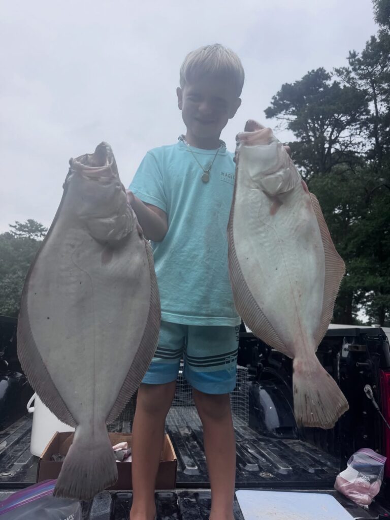
The Barnegat Bay fluke fishing continues to improve. Last week was better than previous and this weekend was the best of the season so far. Dante from Magictails fished with his son and had a banner day in the bay fishing Magictail Hoochie Jig with Gulp Turbo Shrimp.
Bill Bassant shared he had a great day fishing with his son in the bay catching 30 fluke with four keepers between the 19-21-1/2″ range.
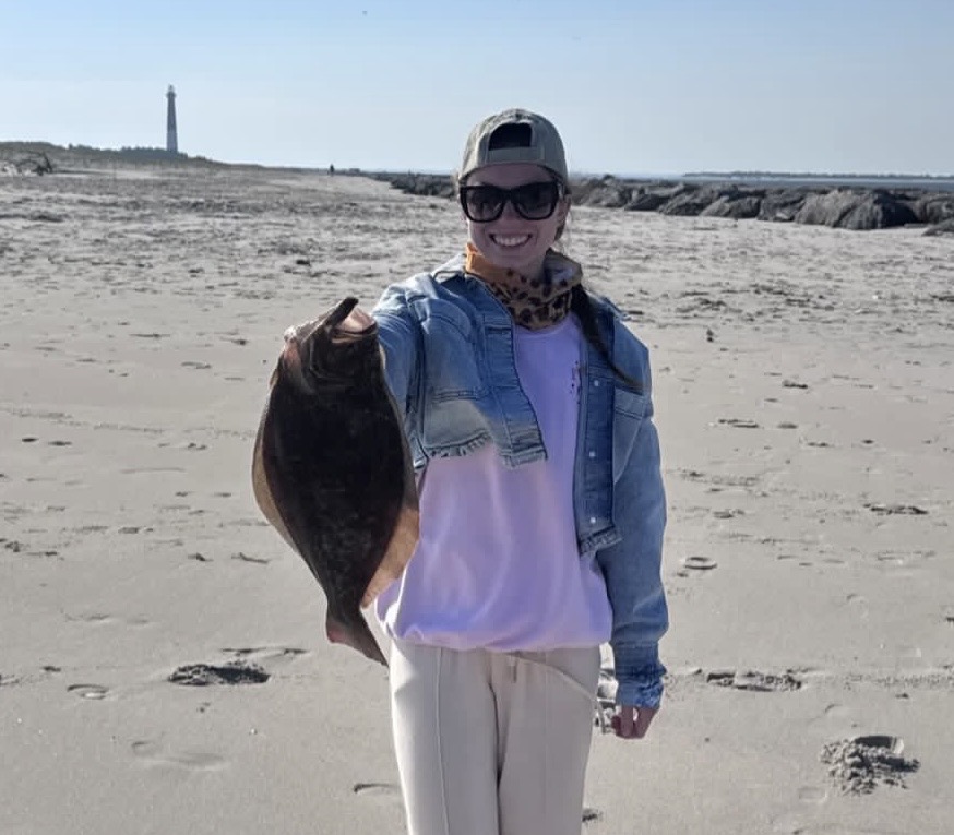
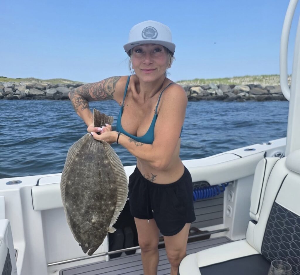
Inlet fluke fishing is always a good bet as it’s a funnel for summer flounder moving in and out of Barnegat Bay. Early season we had some big fluke and more recently some other nice catches have popped up. Kerri Matejovic caught this 25″ fluke this weekend, but a day late for the tournament.
The ocean fluke reports are coming in consistently when the ocean conditions allow the bottom fishing for fluke is good 50-70′ the local wrecks and reef sites. There’s lots of short and on the reefs sea robins have show up. So now expect them to be pecking away.
Fluke Fishing On The Surf
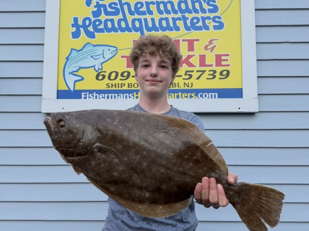
Consistent fluke action was reported this weekend but the majority of catches are shorts. But just like the entire season so far, there are some nice ones in the mix. Case and point… Nicky Bizzarro weighed in a 23″ flatty that he caught off of the mid-island surf. He reported, “We has a dozen smaller fish and another 18-1/2″ keeper.” Another solid surf fluke came in from @chfd098 at 23″ 4.44#.
Surf fluke fishing should be good so long as the surf temps remain warm. Anglers can target with 3-4-5-6″ baits; swimming mullet, grubs, shrimp, jerk shads. Gulp is by far the easiest and also most popular because it is convenient and more over effective. Rigging up for fluke fishing on the surf is easy. A simple jig head with gulp is all you need. Most calm summer days 3/8-3/4 is good but a light tackle outfit must be used to match appropriately.
What’s the best fluke rig for the surf? It’s person preference (and confidence) but also conditions play a roll. Have a heavy outfit? Don’t use a monster jig. It would be better to use a rig with a sinker. Need long distance? A bank sinker, drail weight or a diamond jig with a single drop and smaller baits will be the longest casting. A teaser rig casts good too so long as the teaser isn’t bulky. A hi/lo rig sometimes called a chicken rig is good but two drops with two baits add resistance in the air and water so isn’t the longest cast option and also not the best when there is a sweeping current. A single jig is great and universal but not the longest casting. Pick a right that fits for you. Rig up with Gulp and go hunt the surf’s gutters and toughs. You’ll score!
Bluefish Report Around LBI
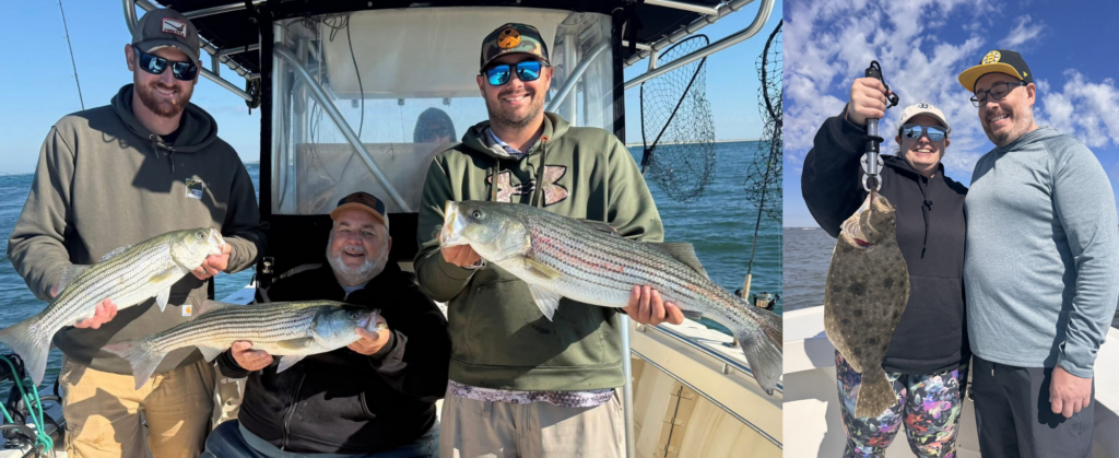
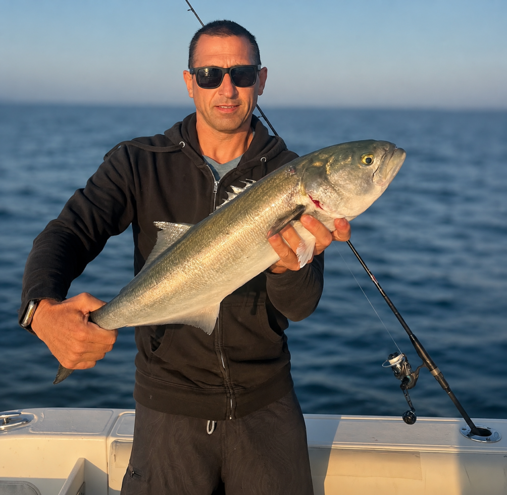
Blues have been around for weeks offering anglers fun with cocktails (1-3#) in the bay, inlet and occasionally the surf. Some days they are aggressively feeding on three-inch sand eels around the inlet. In the bay they are chasing spearing and peanut bunker. This weekend some large bluefish showed up.
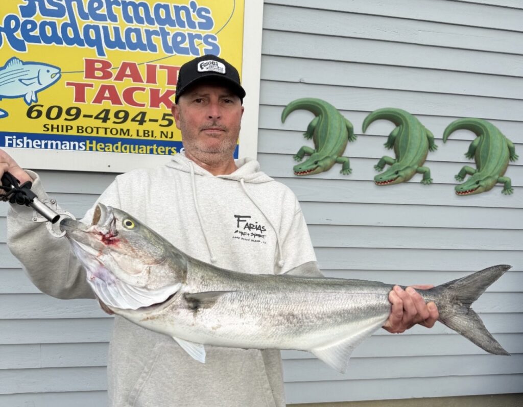
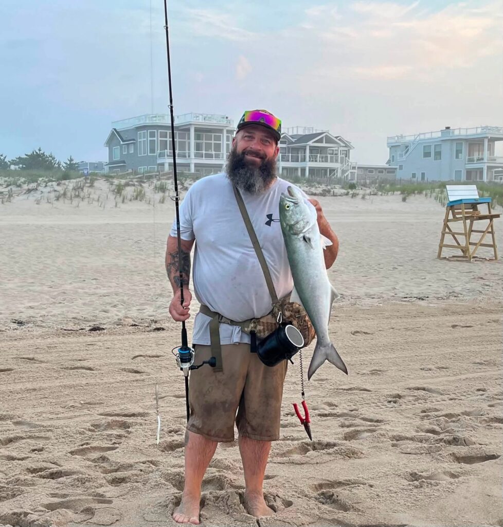
Bubba Williams caught a nice size bluefish off the surf. He reported while fluke fishing he got bit off after seeing a school of bluefish. “Tied on a diamond jig and followed them down the beach. Landed one.”
Dave Werner had a fun morning with bluefish smashing poppers.
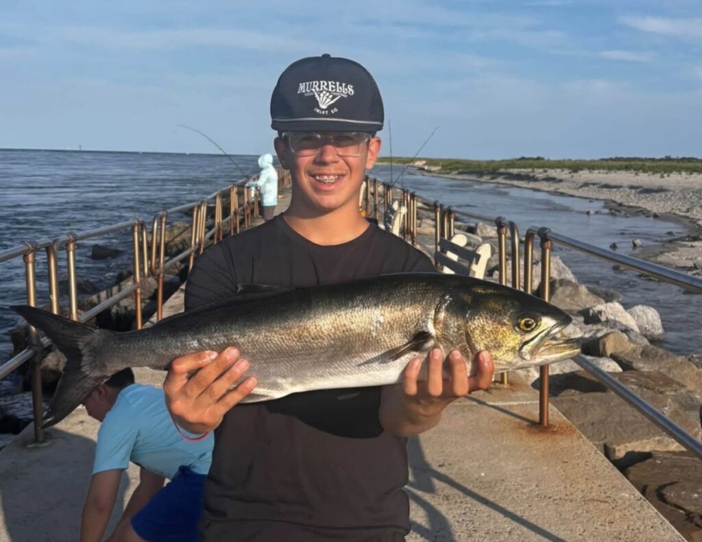
Raymond LeFante shared a photo of his son with a nice bluefish catch from the Barnegat Inlet jetty. He reported, “A few nice blues for Aiden and a bunch of short fluke for Andrew.”
Croakers, Weakfish and Other Summer Visitors
Beyond the fluke and bluefish, there continue to be other varieties.
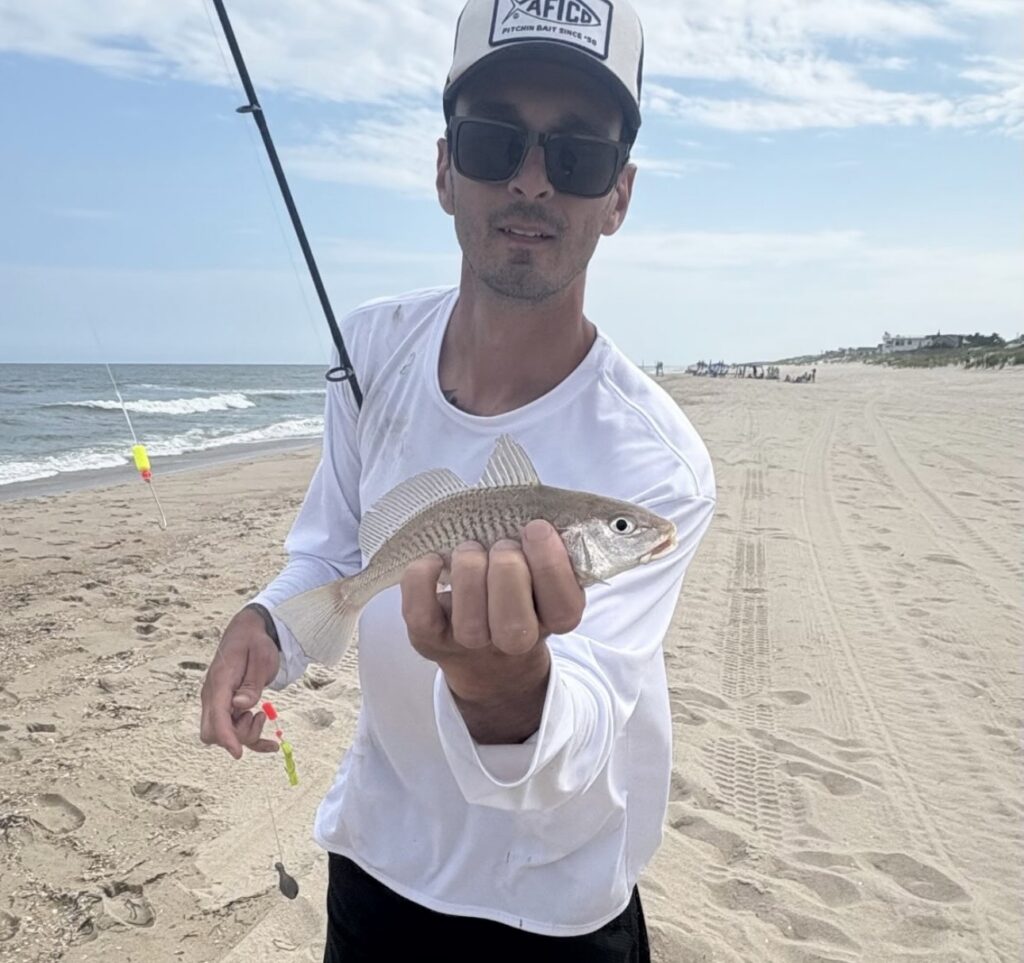
Phil Romanzi found the croakers in the surf using a kingfish pill float rig.
@vitofish961 commented on the last fishing report vlog, “Steady bite of croakers all morning. One gulp shrimp had a blowfish bite.”
So far this season we have had more croaker catches / reports than the last 3-5 years combined. Anglers are finding them on the beach while fishing for fluke and kingfish as well as while fluke fishing the bay. Most are bycatch however if you rig up and target croakers you will catch ’em. It’s simple and they are tasty.
Croakers are small silver fish that are good to eat despite being bony. Cooking wise to me they are similar to a scup/porgy; small, slightly off white meat, mild, flavorful. I gut, scale and pan fry them whole like a breaded pork chop and then pick away! To target use a simple hi/lo rig with #1 – 1/0 hook (a classic sea bass rig will work great) with a piece of Fish Bites, live sand flea, squid, clam or small Gulp. A kingfish rig will do fine too but they are better for the smaller ones due to the smaller hooks which are great for kingfish and spot.
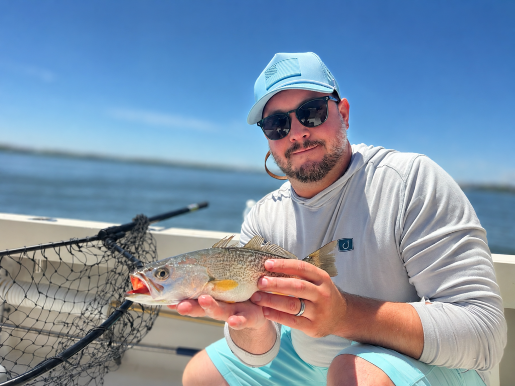
On a recent trip out while fluke fishing we had some small hits and managed to catch one croaker. We scaled down the tackle and a few drifts later we connected with two (13″ & 15″) beautiful weakfish during the slack tide. Both were caught on Gulp Shrimp on a small lead head jig. We tagged them for Grey Fish Research and released. Below is a photo of Paul Sundstrom from Illinois enjoying time on Barnegat Bay catching weakfish, bluefish, fluke… but missed the striped bass for the Grand Slam.
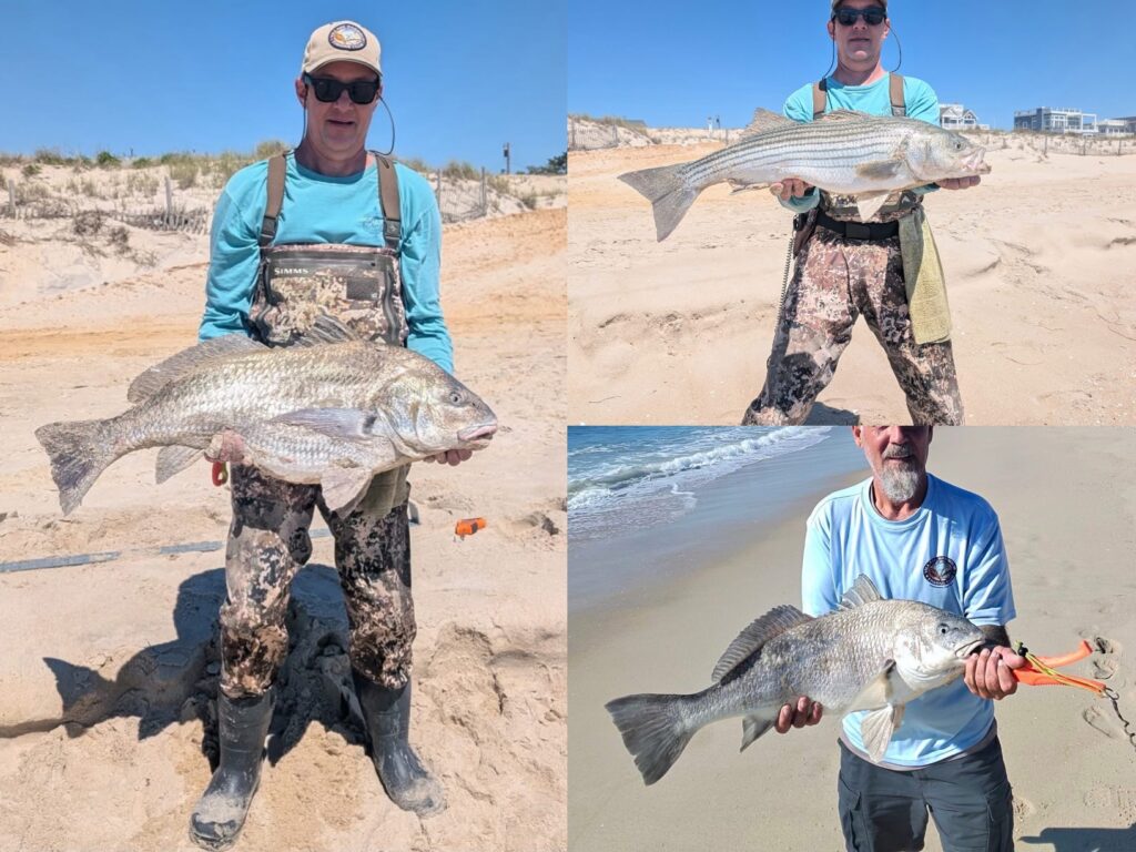
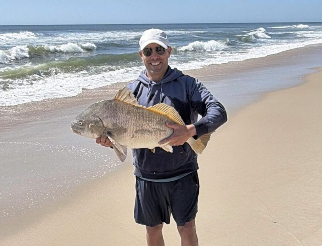
Blowfish reports remain limited for now, but with summer progressing they could begin showing up in greater numbers over the coming weeks. There’s still houndfish roaming around and in the right areas triggerfish and sheepshead.
Mid-Shore & Offshore Fishing Report
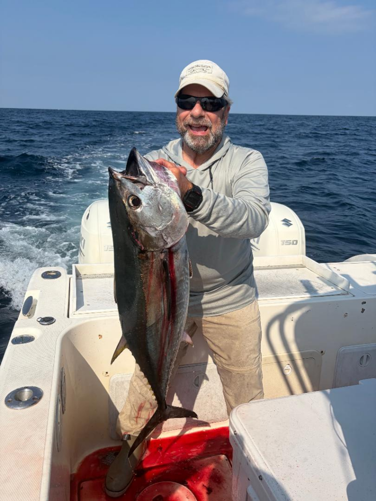
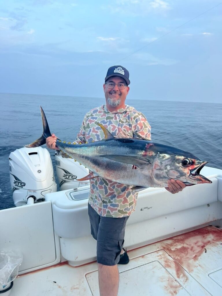
Mid-shore and offshore fishing has been popping off on the mid-shore lumps and at the canyons. There squid on the midshore grounds making for great tuna baits and even better table fare. We have a spread of squid jigs in stock. In the classic 30-40fm areas bluefin are chewing chunks, jigs and topwater. All depends on the day. Mahi catches are starting to become better and this weekend both the Hudson and Toms produced yellowfin and bigeye tuna.
Offshore Ryan Warford shared a report after a fun trip… went 4 for 6 on yellowfin.
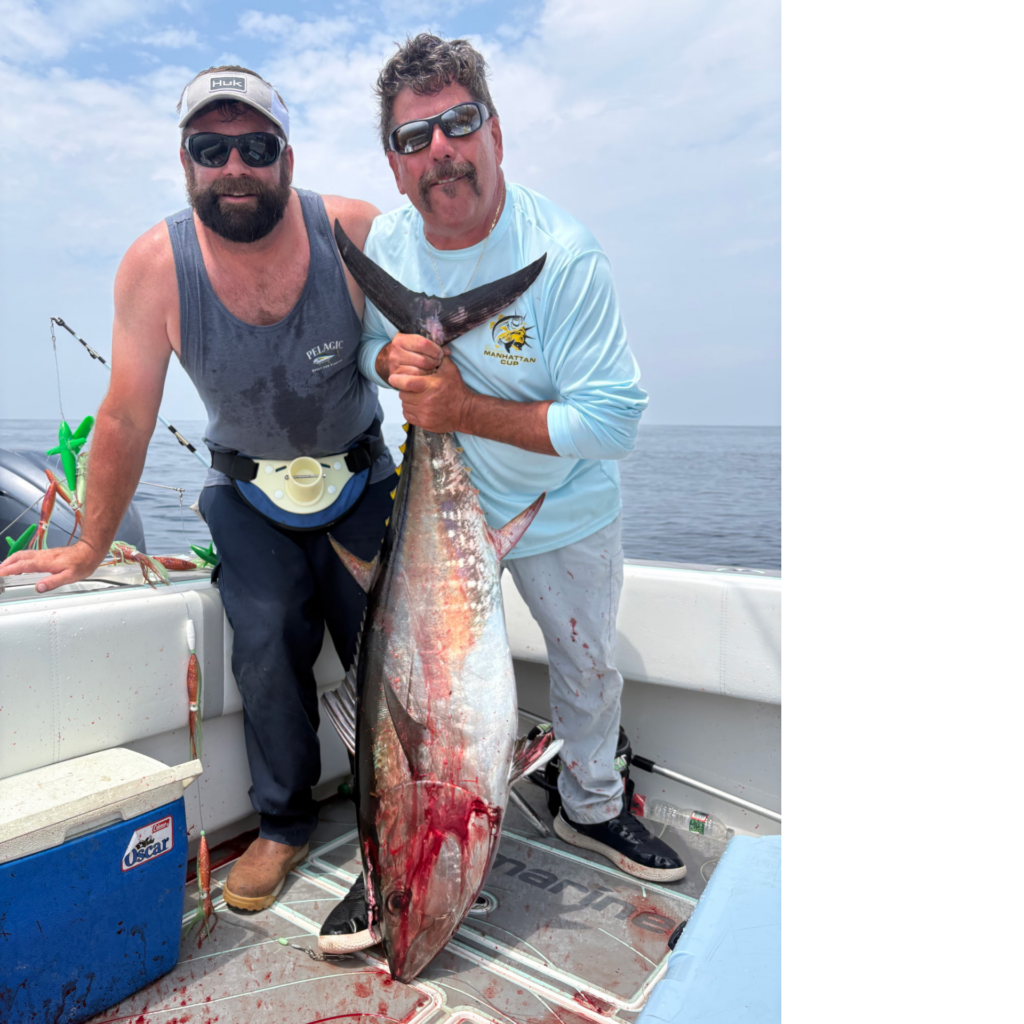
Kevin Kennard caught this 75# yellowfin fishing with Capt Frank Crescitelli.
Important New Jersey Tautog Management Update
I attended the recent New Jersey Tautog Advisory Committee meeting last week where we discussed the expected 40% cut coming for 2027. Yes, you heard that correctly. The Atlantic States Marine Fisheries Commission is expected to request a 40% reduction in tautog removals in the New Jersey – New York Night Region.
Most tautog anglers saw this coming. With the advent of trolling motors, new age sonar, bottom imaging and tackle advancements these slow growing hard fighting fish didn’t stand a chance. I spoke at numerous state meetings sharing that the fishery was great but experiencing (anecdotal) overfishing. We saw the popularity boom and new interest brings new effort / pressure. I was told they needed to wait for the stock assessments. It finally comes and boom. It doesn’t take a rocket scientist to know there is a problem when charter boats out of Manasquan are running 20-30+ miles to tog fish the waters off LBI, daily in the heat of tog season. Clearly Monmouth Co waters were producing or they wouldn’t be running. That was the first major tell tale sign for me. That was years back and it has only trended down from there. Fortunately tog are hardy fish with a very low discard / release mortality rate is low at aboit 2.5% (striped bass is 9%).
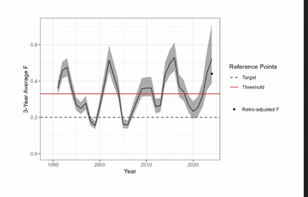
Our region’s (the New Jersey – New York Bight) stock is not overfished but overfishing is and has occurred (2022-2024) so the reduction is necessary. There’s three levers to pull; minimum size limit, bag limit, days / season. Based on our discussions, going up from the current 15″ to 16″ will achieve approximately a 27% cut. A jump up to 17″ might get us to 31%, so we can’t meet the cut with just minimum size. The bag and or the number of days will most likely be trimmed. I’m going out on a limb and saying we’ll most likely get 16″ with one less fish during the Jan/Feb/April/Nov/Dev months and then a loss of a few days. We’ll see. I think there also needs to be an added clause no live possession without commercial permit to hopefully help curb illegal fishing and black market sales.
At this point I’m just sharing the news of what’s most likely coming. Exact regulations will not be finalized for some time. But all tautog anglers should stay tuned!
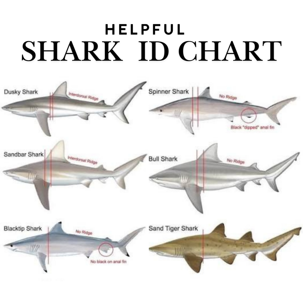
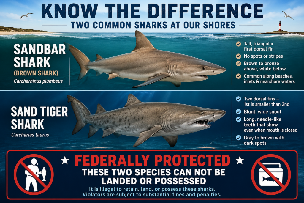
Responsible Shark Fishing Matters
With summertime shark fishing in full swing, it’s important that all anglers know the regulations before heading out. Sandbar sharks (brown sharks) and sand tiger sharks are federally protected and cannot be landed or possessed. If one is caught, it must be released while still in the water. Pulling any fish up onto the sand is considered landed. Anglers are allowed to target sharks and rays however direct intent to target federally protected species is illegal. Enforcement is on patrol checking beaches and alos surfing social channels and issuing fines digitally. This is your warning. Please proceed with caution. And as always fish responsibly and use common sense. Stay away from swimming areas and do not shark fish during lifeguard hours of 10am to 6pm. Fish before or after the guard’s patrol.