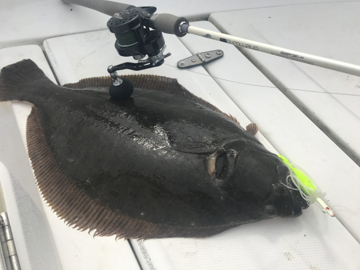
April 11, 2024 at about 7am, I got a call from a friend, “There’s a dead whale washed up on the beach in front of my house.” I had to check it out. I took some photos and videos and stuck around for about two hours to soak in the scene. While on the beach, I saw another whale (possibly more than one) breach four times out in the distance. I pointed it out to three ladies standing near me and they managed to see one of the blows, their first ever. It was exciting for them. However these very distinct and pronounced blows sent an eerie chill down my spine. The hair on my arms stood up like a porcupine. Was that the mother?
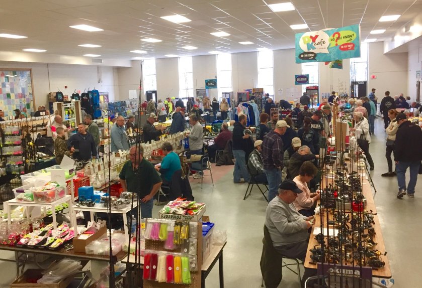
This wasn’t my first stranding event. For me it all started on December 24, 2020 when a dead humpback washed ashore in Barnegat Light at the north end of Long Beach Island. I made a short video to document the event. (See end of post under 12/24/20 Event) Being a saltwater angler, I frequently fish alongside whales both inshore and offshore. But this event really got me thinking, reading and researching. Since then, I went out of my way to witness first hand as many local strandings as possible. Little did I know at the time that there were a lot of events coming!
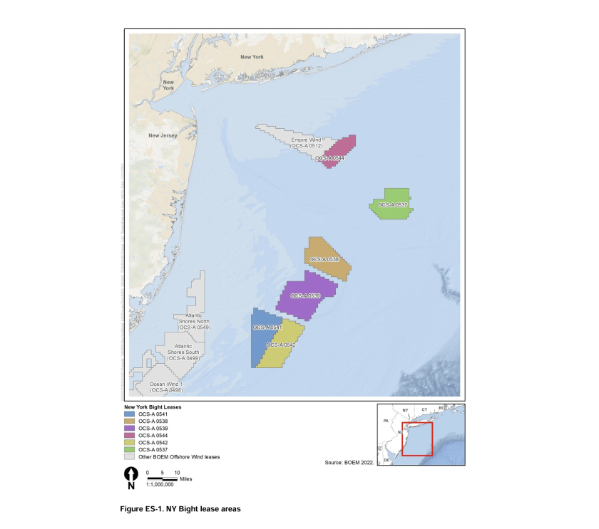
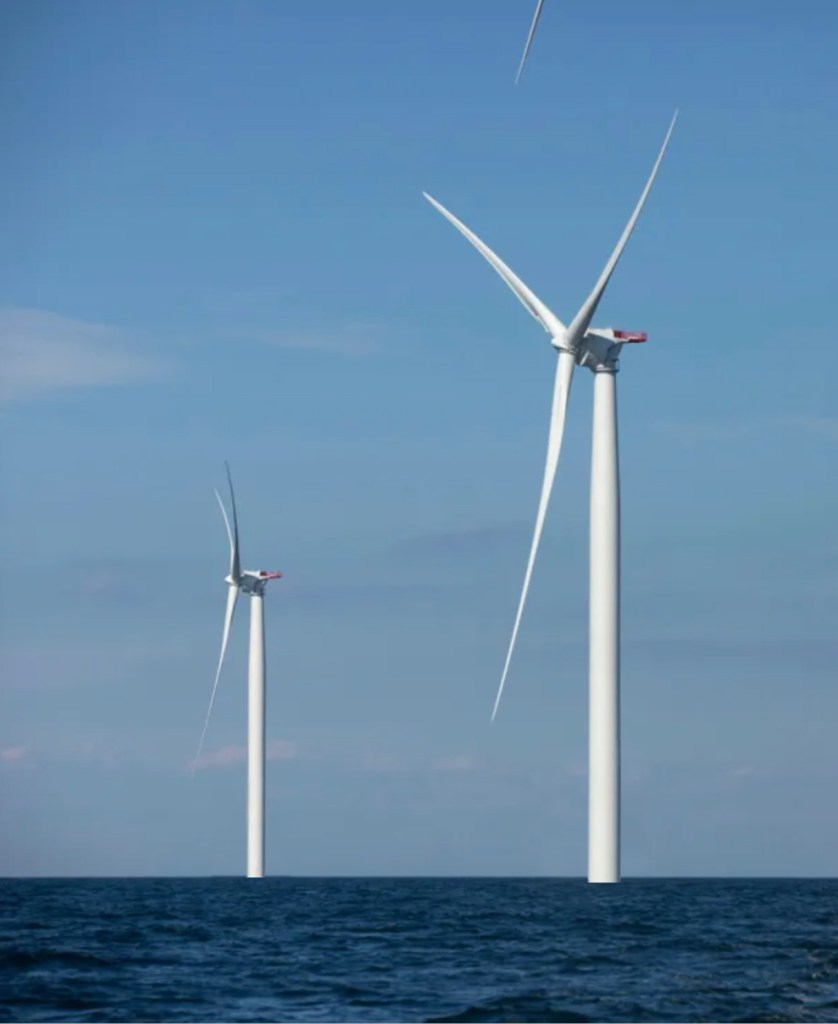
In the Northeast United States, developers have spent billions of dollars on offshore wind projects to tap into the lucrative energy markets and access state-level subsidies for carbon-free electricity. However, the Bureau Of Ocean Energy Management (BOEM) and the National Marine Fisheries Services (NMFS once known as NOAA Fisheries) have failed to properly assess the offshore wind industry’s impacts on endangered and threatened marine wildlife as well as the fisheries in the western Atlantic. And, the Bureau of Safety and Environmental Enforcement (BSEE) has failed to monitor and enforce. Still today, they fail to recognize the cumulative impacts which ongoing geophysical and geotechnical survey operations have on cetaceans and other marine life.
Offshore Wind & Whales
The string of marine mammal mortality events that escalated in the winter of 2022/2023 was alarming. During the early stages of these events I closely followed these events and attended local strandings; Atlantic City 12/23/22, Atlantic City 1/7/23, Brigantine 1/12/23, Manasquan 2/13/23, Seaside Park 3/2/23. I also closely followed the activities of the many survey ships in the region. I found it disturbing and strange that the many NGO (non governmental organization) pro-wind groups were NOT hot on the topic. They were strangely quiet for a long while. It took trending social media and eventually mainstream media to get them to even speak on the topic.
When Clean Ocean Action issued a press release on Jan 9th and called for an investigation, I was taken back by the many NGO’s responses which did not concur. What’s to hide? New Jersey’s Governor Phil Murphy (a big league offshore wind advocate) quickly said, “There’s no evidence at all that these are related to the offshore wind activities.” Well at that time and still today there is no evidence they were not related. Fortunately congressman Chris Smith took action and called for “an immediate, comprehensive investigation into the environmental approval process for offshore wind projects” by BOEM & NMFS. As time went on a large movement has formed demanding an investigation and a “Pause Until We Find The Cause.”
But, neither took place. And the whale death toll rose. So… Do the many whale deaths have any relationship to the large-scale offshore wind survey activity in the region?
Let me be clear. I’m not a whale expert. I'm not a scientist. I am a recreational fishing stakeholder that has dedicated far too much of my life monitoring the offshore wind developments, reading all of BOEM's offshore wind documents as well as many peer reviewed documents on the vast topics. I have attended far too many offshore wind meetings (both public and private). And I’ve read far too many news articles with regurgitated verbiage from state, fed and pro-wind NGO press releases. I wrote this, Part 3 of NJ’s Offshore Wind Fiasco - Offshore Wind & Whales, to share my deep concerns with others. I DO NOT support the industrialization of the oceans. I DO NOT support the fast tracking of offshore wind. Offshore Wind is not solving any existential threats which proponents claim. It is only creating a multitude of major problems in the marine ecosystem and these are only the early stages.
What’s going on with the whales?
In 2017, NOAA declared an active unusual mortality event for Humpback whales along the East Coast. Experts say they don’t totally know why whales are dying at higher than normal rates. Some seem scared to speak up and go against their own environmental community, most of which wholeheartedly support offshore wind.

Humpback whale strandings, Maine to Floirda 2011-2023 (‘23 through August).
Red bars show years of the declared UME.
NOAA’s Chief of Endangered Species Dr. Sean Hayes surprised many with his warning letter to BOEM that offshore wind projects posed existential threats to marine life not only during construction but throughout normal operations. As Hayes writes in his letter:
“risks occur at varying stages, including construction and development, and include increased noise, vessel traffic, habitat modifications, water withdrawals associated with certain sub-stations and resultant impingement/entrainment of zooplankton, changes in fishing effort and related potential increased entanglement risk, and oceanographic changes that may disrupt the distribution, abundance, and availability of typical right whale food (e.g. Dorrell et al 2022).”
“However, unlike vessel traffic and noise, which can be mitigated to some extent, oceanographic impacts from installed and operating turbines cannot be mitigated for the 30-year lifespan of the project, unless they are decommissioned.”
Dr. Sean Hayes
That is some really serious verbiage! Nonetheless, in this Jan 18, 2023 NOAA press conference on East Coast whale stranding (which I attended), Lauren Gaches (NOAA Fisheries Public Affairs Director) stated “to date, no whale mortality has been attributed to offshore wind activities.” But the entire presentation FAILED to clearly state that without a doubt offshore wind survey activities have absolutely NO direct or NO indirect association to any of the whale deaths. She basically spoonfed the national press who are not well versed on the topic and not willing to take a deep dive.
At the time Murphy, who has aggressively raised state OSW generation targets (the direct cause of the fast tracking) said, “They (NOAA) have said it’s been happening (whale stranding aka deaths) at an increased rate since 2016, and that was long before there was any offshore wind activity.” Well, that is not true. In 2015 there was construction activity at the Block Island Wind Farm. Here’s a Newport Rhode Island news article from 2017 possibly one of the earliest in the states to question the link between whale strandings and offshore wind. Here’s a document dated Aug 30, 2017 to Ocean Wind, LLC on Project Name: Denmark Oil & Natural Gas Energy (DONG energy is now Orsted), in regards to 2 geotechnical test cores at 39 separate sites in the Atlantic Ocean approximately 11 miles due east of Ocean City, NJ. And the Bay State Wind (DONG/Orsted) five year site assessment term started on June 29, 2017. To the best of my knowledge Bay State Wind did not have IHA permits and at that time there was not an IHA mandate. There’s also possible links questioned by marine environmental experts in Europe as well as an environmental blogger.
Two Unprecedented Occurrences
The waters from Cape May to Montauk have NEVER seen this many cetacean deaths (whales and dolphins) in such a condensed time frame. EVER!!! These same waters have NEVER EVER had this extent and duration of geophysical and geotechnical survey activities. EVER! There is a suspicious correlation with the surge in whale deaths with the increase in offshore wind survey activity.
Noise Pollution – Whales Are Sensitive to Sound
As I published (August 23, 2022) NJ Offshore Wind Fiasco P2, there are concerns with regards to offshore wind noise pollution. Sound is critical for marine mammals to navigate, communicate, feed, reproduce and much more. Whales are acoustically sensitive and evidence shows sound affects their behaviors. Humpback whales are disrupted by survey activity, and thus merits further attention and study, and potentially conservation action. (Cerchio Et al., 2014) But studies on large whales have not been done because few members of these species occur in the wind energy areas in European waters. (Kraus Et al., 2019)
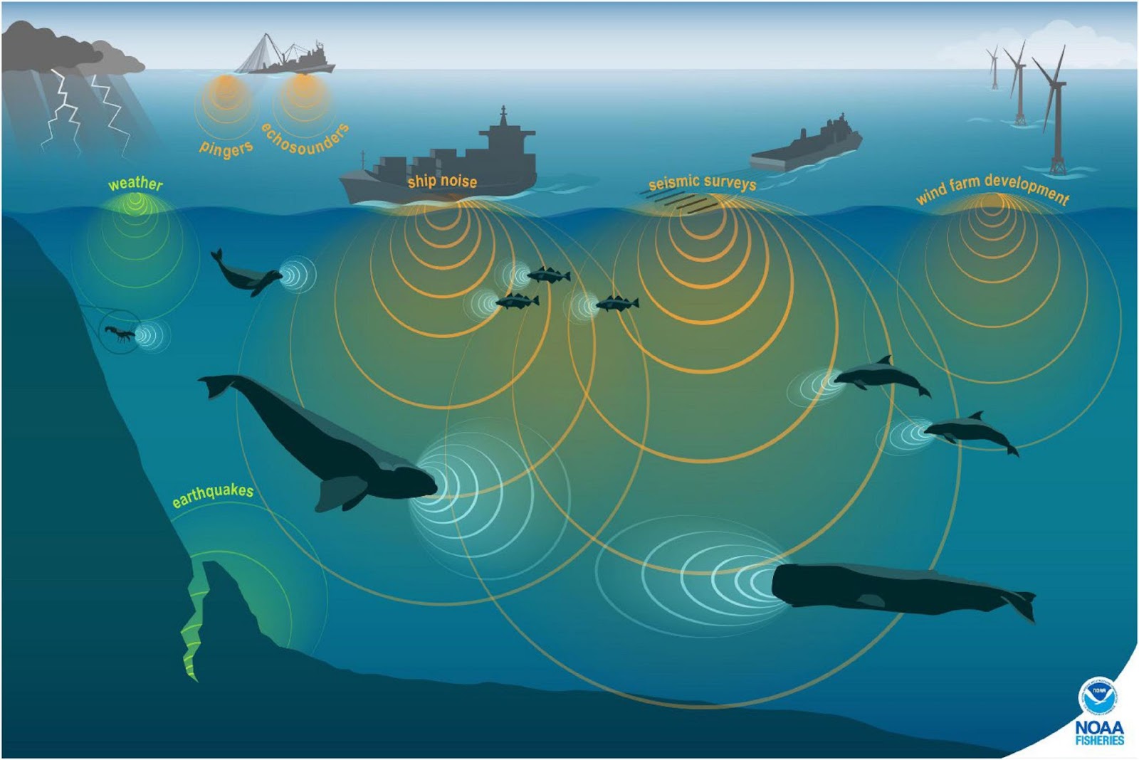
Whales are vulnerable to harm from offshore wind energy, especially Baleen whales which use low-frequency sounds. According to San Diego State University biologist, because of their bone conduction, baleen whales (14 species including humpback, rite, fin, sei, minke) are particularly susceptible (4-10X more sensitive) to negative effects from noise pollution. The majority of local strandings have been humpbacks.
As per Sea World’s All About Baleen Whale Communication, “The repertoire of baleen whale sounds includes very low-frequency (20–200 Hz) moans, grunts, thumps and knocks; and higher-frequency (above 1000 Hz) chirps, cries, whistles, and songs. Humpback whales also produce a series of repeating units of sounds (up to 8,000 Hz) that are classified as “songs”.
Several studies on the effects of noise on marine mammals have documented a broad range of negative effects, from masking of signals and avoidance behavior, physical injury, cessation of feeding, and increased stress (Richardson et al., 1995; Hildebrand, 2005; Weilgart, 2007; Rolland et al., 2012; DeRuiter et al., 2013; Dunlop et al., 2018; Bröker, 2019). There’s possibilities of both temporary threshold shift (noise-induced hearing loss in marine mammals) and permanent hearing damage, loss of communication and navigation as well as displacement from habitats and migration routes. (National Academies, 2017). Section 1.1 gives an example of potential stressors associated with offshore wind being “animals could be displaced away from a wind installation into nearby shipping lanes”. This sheds a little light on the problem.
While baleen whales do not possess the advanced echolocation abilities of toothed whales, they still use echolocation to some extent. Baleen whales emit sounds and listen for the echoes in their environment for communicating.
This study (BOEM Report No. 5586) states avoidance behavior of grey whales (a Baleen whale) began at sound exposure levels of around 110dB and levels of 180db produced nearly complete avoidance of the area. The study found whales changed course to avoid noise in their migratory path. Will other Baleen whales react in a similar way? In the case of NY Bight geotechnical and geophysical survey operations, emissions levels were/are at or in excess of 140-150dB.
In regards to the NY Bight, so far only pre-construction surveys have taken place. But if the irresponsible fast tracking of development is left unchecked, one day in the not so distant future pile driving noise could be a new major stressor for whales in the region. University of Rhode Island’s (URI) Dr. James Miller shares that construction is VERY loud, “sound is detectable 50+ miles from the site.”
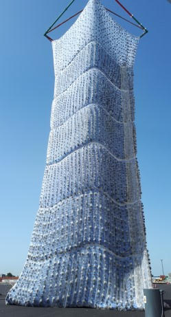
This noise pollution even with sound mitigation techniques called bubble curtains can displace marine mammals 10km+ range from the construction site. The idea is for the bubbles to absorb and reflect the sound energy. But as per James Miller (bioacoustics export at URI) it only reduces the sound energy by about 10dB. Because developers know this isn’t enough and there is still a huge risk to marine life, a hydro-sound damper system was developed (shown). This is a photo I got from Vineyard Wind, but I could not find any details about them, their use or their sound reduction capabilities.
There are major concerns with regards to pile driving. And just like the survey stage, as construction sites expand and fill out the region, there is an IMMENSE CUMULATIVE IMPACT!
“It is absolutely ridiculous allowing international companies to blast our coastline, with no benefit for local communities or regard for marine life. The onus should be on the proponent to prove no harm, and the precautionary principle should be implemented until that is the case.”
Ally King, Surfrider Tasmania
This is a great quote from Surfrider Tasmania President Ally King but in this case King was talking about survey activity for oil. Surfrider whole heartily supports Offshore Wind in NJ/NY Bight with none of these “precautionary principles” of concern.
What Survey Work For Offshore Wind Was Done?
Survey work (off NY/NJ) for engineering and environmental purposes is characterizing the sea floor and the immediate sub-bottom profile. The exact work that each vessel was and is conducting and the exact equipment being used is somewhat unknown (to me, but must be documented somewhere) but this document details Geophysical & Geotechnical (G&G) Investigation Methods.
Geophysical Operations
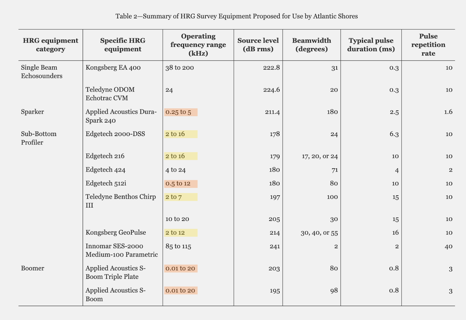
These surveys use sensors that are mounted under and/or towed by a vessel to map the seafloor, identify physical objects and characterize bottom habitats. This equipment also collects information of soil type on and below the seafloor. Equipment used ranges from multibeam depth sounders, gradiometers (magnetic intensity measurement), side scan sonar (seafloor imaging), pinger/chirp (shallow penetration sub-bottom profiler, 0-5m below seabed), and chirps/ parametric profilers/sparkers (medium penetration sub-bottom profiler, down to 100m below seabed). “Geophysical surveys are expected to use several equipment types concurrently in order to collect multiple aspects of data along one transect.” The document goes on to spell out, the High-Resolution Geophysical “survey equipment produces sound that has the potential to result in harassment of maine mammals.” As per Table 2 (found in the document linked to above as well as included below; yellow highlight risk, orange highlights higher risk) Sparkers (0.25-5kHz) and Boomers (0.1-20kHz) operate within the frequency range which Sea World lists are within the vocalization frequency range of baleen whales.
Geotechnical Operations
These surveys collect soil samples from the seafloor and seabed to analyze and determine the composition of sediments in specific locations. This work, which is and has been active, includes seabed CPT (cone penetrometer testing) and types of drilling – boring work which requires equipment that is affixed to the seabed which captures samples.
While there was chatter on social media about seismic blasting and more extreme testing, these methods are not listed as being used. A double-plate boomer was used to survey the Virginia Wind Energy Area (Fugro, 2013) and recorded over 400ms (two-way travel time) of data which corresponds to approximately 350 meters below the seafloor. Another method, the Sparkers (Dura Spark 240 UHD Unit) puts out 200dB+ and penetrates deep (100m-1km) into the bottom.
Get Out Of Jail Free Card?
When an activity may reasonably anticipate an incidental take of marine mammals, an Incidental Harassment/Take Authorization (IHA/ ITA) under the Marine Mammal Protection Act (MMPA) is applied for. And that is what the developers have done. For these ITA’s level B harassment (behavioral disturbance) is anticipated and authorized; however, no (level A harassment) injury and no mortality is permitted.
- Incidental Take Authorization for Atlantic Shores – As per the application, “Because Atlantic Shores proposes to use survey equipment that will operate below 180 kilohertz (kHz) we are requesting an Incidental Harassment Authorization (IHA) for the taking of marine mammals by Level B acoustic harassment as defined by the MMPA”
- Incidental Take Authorization for Ocean Wind – As per the application, “Both NOAA and BOEM have advised that the deployment of HRG survey equipment including the use of sound-producing equipment operating below 200 kHz (e.g., sub-bottom profilers) has the potential to cause acoustic harassment to marine species, in particular marine mammals.
“Installing piles using impact and vibratory pile driving and site characterization surveys may result in the incidental take, by Level A harassment and/or Level B harassment, of marine mammals. Therefore, Atlantic Shores requests authorization to incidentally take marine mammals.“
In Conclusion
If you have made it this far along, it’s safe to say you are interested in the topic. I assume you too agree… We have a problem! The details are damning and offshore wind survey activity must be scrutinized and investigated.
I again commend Clean Ocean Action for standing up and raising awareness to the topic early on and staying on top of it. Too many well funded NGO’s continue to boast their blanket statement in an attempt to sweep it under the rug. They proclaim “No Link, No Evidence, No Connection” putting the blame on climate change, vessel strikes/shipping, plastics and entanglement (commercial fishing gear), all known causes of whale deaths. But they will never consider survey operations as a potential contributing factor of one or more of the events. If they aren’t a factor why request for IHA’s?
When evidence of a ship strike (blunt force trauma) is present, they want everyone to believe that is the definite sole cause of death. Failing to consider the other factors which very well may be the root cause of many mortality events is irresponsible.
The circumstantial evidence is alarming, BUT without ear bone samples/biopsies to determine auditory damage to the ears, the necropsies may never directly link. So yes the claim is true, “NOAA Fisheries has stated no whale deaths have been attributed to offshore wind activities.” But the absence of evidence is not evidence of absence.
What a radical environmental narrative to take over the oceans by way of offshore wind and soon… The New Blue Economy! Yes, massive scale aquaculture is in their plans and it is quickly coming down the pike. It’s not a conspiracy. It’s no longer secret and they are rewriting the laws to support the scheme.
Also coming at us point blank…
NOAA Fisheries is proposing limiting speeds for all vessels 35 feet or longer to 10kts off the Atlantic Coast from Massachusetts to Northern Florida. The speed limit would last up to seven months in some parts of the Atlantic coast and would extend up to 90 miles offshore. It’s terrible news for offshore anglers, but fortunately the American Sportfishing Association and NMMA is active on the topic. We commonly run to the canyons and fish with whales frequently. Healthy whale strikes are exceptionally rare. Also NOAA is pushing hard on a new proposal called the Hudson Canyon National Marine Sanctuary which is part of the bigger push, 30×30. An effort to conserve and possibly close 30% of America’s land and water by the year 2030. While it sounds like there are good intentions, misguided groups are calling for anglers to be denied access. To learn more here’s 10 30×30 Sportfishing Articles.
This all seems like a bad dream but it’s the new reality!
NJ's Offshore Wind Fiasco Part 1.

NJ's Offshore Wind Fiasco Part 2 which touched on the ocean, environment and more specifically the fisheries.

This was Part 3 in all about OffShore Wind & Whales.

Part 4 will outline topics concerning everyone; energy policy, economics and feasibility.

12/24/2020 Event – LBI Stranding
At the start of this, I shared it all began for me on December 24, 2020 when a dead humpback washed ashore in Barnegat Light. After taking some photos and video I made the edit and posted on YouTube but my story did not end there. It took a couple years and lots of digging to learn there were things going on offshore in the area.
After reviewing USCG documents I found, the M/V Fugro Enterprise conducted geophysical survey operations mapping the seabed as well as sub-bottom profiling during the month of December 2020. These operations for offshore wind energy development were done 9-20 miles off of the NJ coast between Barnegat Light and Atlantic City.
In the image below… The black dot is the location of the humpback stranding which washed up December 24-25, 2020. The blue lines are the vessel tracks of the Fugro Enterprise in the 10 days leading up to the stranding event.
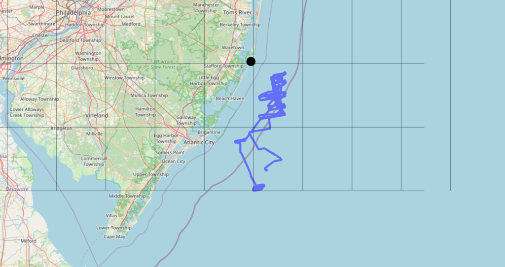
I’m almost certain, but I can’t prove it, the Fugro Enterprise killed this whale during its survey operations. The circumstantial evidence in this particular event as well as many other stranding events is alarming.
It’s unclear which exact geophysical methods the Fugro Enterprise used. But it should be of particular concern because in many occasions, the Fugro Enterprise is operating in the areas in the day leading up to stranding events. Why no investigation?